

Trip description
Travelling along the legendary Pamir Highway, most of the travelers fall in love with gorgeous snowcapped tops of over 6000 meters, proudly standing in both sides of the road. Most of these virgin peaks stands quite near to the road, which attracts the lovers of high alpine climbing even more. Waving among the feedbacks of our customers, we decided to combine the classic jeep tour through the Pamir Highway with challenging ascensions to 6000m and higher peaks.
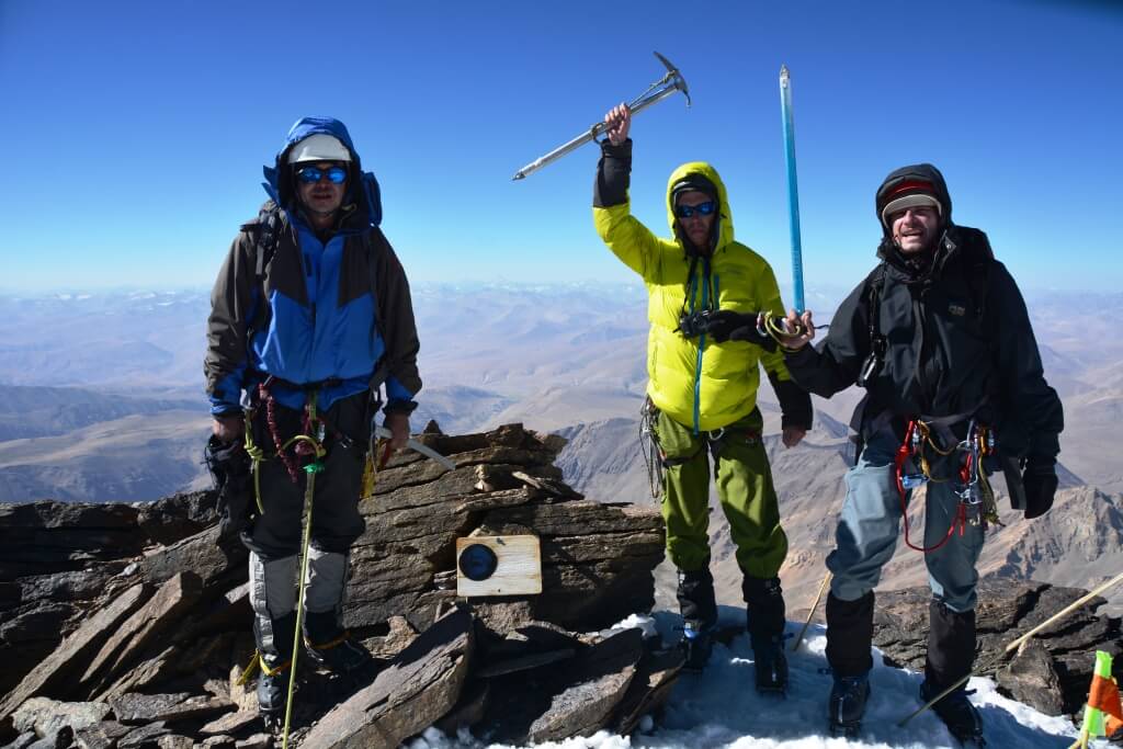
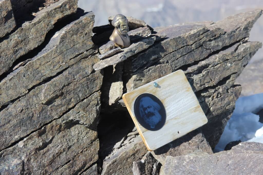
Karl Marx Peak 6726 m – one of the most beautiful and highest peaks of South-Western Pamir of Shakhdara range, Tajikistan. First ascension was made by Soviet Alpinists in 1946. The hardest route lies along northern 2-kilometres height wall. Classical and the easiest route runs along south-western ridge. There are a lots of beautiful, easy and interesting peaks for acclimatization around the Base Camp with 5 – 6 km altitude, including well-known Engels Peak 6510 m, Churlenis Peak 5794 m, Danilaytis Peak 5837 m and other.
The best time to run this trek is mid July to end of September, as the route mostly run on the height of 4000 – 6000 meters and the use of mountaineering gear (see the Recommended equipment list below) and previous experience of climbing is necessary.
A good fitness is simply necessary to participate in this tour, as each participant must carry part of the food, equipment and personal belongings. It is possible to hire porters, which should be condemned in advance. Pack animals will be used only for the first three days of the trek before stepping into the glacial surface, then the group will carry the luggage between the camps. The trek requires several crossings of the rivers.
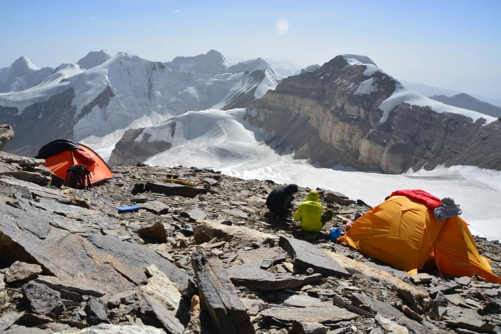
During the ascension we use 4 camps: BC – 3800m, C 2 – 4300m, C 3 – 5300m, C 4 – 5900m
Highlights
- Ascension of Karl Marks peak 6726m – one of the most famous tops of ex-Soviet Union.
- Optional acclimatization ascents to Engels Peak 6510 m, Churlenis Peak 5794 m, Danilaytis Peak 5837 m and other
- Exploration of Wakhan valley, lifestyle of locals, wonders of ancient Silk Road
Itinerary
The guide and drivers meet you at Dushanbe airport and after loading the luggage, we head straight to Pamirs. Driving along Pamir Highway and enjoying the views from high passes, we arrive in Kalaikhumb and stay overnight here in local guesthouse. The day after, we continue our journey along the border with Afghanistan to Khorog – the capital town of GBAO. The rest day we spend with acclimatization before hiking and sightseeing of Khorog. We can visit Botanical garden – the second highest in the world, Central Park and handicraft shops while our guide will manage with last preparation for climbing the 5700m peak. Overnight in guesthouse in Khorog.
Total driving: 14 hours,
Altitude: 2200m↑
We finnish last preparation in Khorog and start driving along Wakhan corridor to Vrang. Meeting the guide, trekking team – animal drovers with their donkeys. Packing food and equipment. Overnight in homestay in Vrang.
Time: 5-6 hours
Distance: 200km.
Altitude: 3000m↑
We start at 6:00 a.m. early morning. From this day further overnights we spend in tents.
Hiking: 10 hours
Up: 1100m
Distance: 9½ km
Altitude: 3800m↑
Start: at 7:00 a.m.
Hiking: 6 hours
Up: 610m
Altitude: 4300m↑
Acclimatization hike to Camp 5300 than back to Camp 4300. Rest and overnight in Camp 4300.
Altitude: 4300m↑
Acclimatization. Rest and overnight in Camp 4300.
Altitude: 4300m↑
Hiking: 7-8 hours
Up: 1100m
Altitude: 5300m↑
Ascension of Ovalnaya Peak 5900 and descent to Camp 5300.
Altitude: 5300m↑
Acclimatization in Camp 5300. Ascension of surrounding peaks.
Altitude: 5300m↑
Start at 6:00 a.m. from Camp 4 to the top. Normally the group should reach the top about 2:00 – 3:00 p.m.
Hiking: 8 hours
Up: 900m
Altitude: 5900m↑
Start at 6:00 a.m. from Camp 5900 to the top. Normally the group should reach the top about 2:00 – 3:00 p.m.
Hiking: 12-15 hours
Up: 900m
Down: 900m
Altitude: 6726m↑
Hiking: 7 hours
Down: 1600m
Altitude: 4300m↑
Hiking: 3-4 hours
Down: 560m
Altitude: 3800m↑
Reserve day. Reserve days needed for the preparation of the group prior to technically difficult sections of the route, rest and in case of bad weather or other unforeseen circumstances.
After reaching Vrang we meet the driver and start driving to Yamchun. We will go to relax in Bibi Fatima thermal spring after long hikes in the mountains. Celebration of successful ascension. Overnight in guesthouse.
Hiking: 2-3 hours
Down: 980m
Altitude: 3000m↑
Today we drive back to Khorog, en route making stops at historical and natural sites of Wakhan valley. We stop for lunch in Khorog, than continue our journey towards Kalaikhumb, where we stay for overnight in guesthouse.
Drive: 9 hours
Distance 440km
Altitude: 1200m↑
Drive back to Dushanbe along Panj River. Overnight in hotel.
Drive: 7 hours
Distance: 360km
Altitude: 800m↑
The group can have a rest or spend the day with sightseeing of Dushanbe. Tour ends with transfer to airport.
| Dates | Availability | Prices | Single suplement |
|---|---|---|---|
| 2 Aug - 22 Aug | Available | US $2,600 | US $200 |
What’s included
- All transportation service 4WD vehicles with drivers
- Airport transfers on arrival and departure days
- Accommodation in 3 star hotels in Dushanbe
- Guesthouse and Homestay accommodations en route
- Twin share tents during the expedition
- Luggage transfer with donkeys
- Animal drovers service till Base Camp
- Mountain guide service
- Mountain guide assistants
- All park entrance fees and trekking permits
- All group camping equipment
- Boiled water provided 3-4 liter per day
What’s not included
- Sleeping bags and mats are not provided but can be hired locally
- Personal climbing gear
- International airfares
- Visas
- Travel Insurance
- Meals and beverages not mentioned in the program
- Items of a personal nature such as laundry, phone calls, alcohol, etc
- Tips and gratuities
List of Equipment recommended for this trip:
Basic Equipment:
- Iso-mat (suitable for snow / ice subsoil)
- Accessory cord 12 m
- 5x carbine hoeses
- adjustable mountaineering harness
- ascender
- icecrew
- ice axe
- Thermo underwear (2 sets, 1 x long-sleeved , 1 x shortsleeved)
- 1 pair of gaiters
- warm cap
- warm gloves (e.g., ski gloves or woollen mittens)
- 1 sleeping-bag (down or hollow fiber) suitable to - 15 ° C
- 1 forehead lamp or flashlight
- Solar protection (headgear, sunglasses, solar cream)
- personal medication (pain means, fever-lowering drugs, diarrhoea medications, means for wound disinfection, plaster, bandages, elastic bandage, small scissors, tweezers, safety pins, medicine against flu, sore throat and coughing, eye drops)
- 2 long trousers, one of it trekking trousers
- 1 pullover (woollen or fiber fur)
- Sea bag or backpack for the main luggage
- ankle-high trekking shoes with profile sole and matching climbing irons
- Telescope ski sticks as a walking help
- Water bottle with 1 litre of capacity
- Thermos bottle with 1 litre of capacity
- suitable hiking clothes (T-shirt, hiking socks)
- 1 anorak, wind and water proof (e.g., Goretex)
- 1 overtrousers, wind and water proof (e.g., Goretex)
- Toilet paper
- personal dishes spoon, fork, small knife, soup plate, mug (unbreakable and light material)
Additional Recommended Equipment:
- Rain protective covering for the backpack
- Comfortable shoes or sandals
- Photo equipment, films, binoculars
- Penknife
Safety
Even if the program is specially designed for people who have no experience of high-altitude climbing, the ascension of almost 6000m height requires good physical shape. The teammates have to climb the steep (40-55 °) ice-snow slopes and ridges with a variety of snow eaves, the passage of which, requires intense free climbing and experience of using the climbing gear and technique of moving on the piedmont relief.
Climbing gear: expedition boots, crampons, ice axes, carbines, hammers, expendable cord, ropes, and harnesses. The route requires several river crossings. An experienced mountain guide will accompany you during the hike, and give you brief explanation of using the gear and crossing the hard parts of expedition.
Notes
Please note, that the guide can alter the planning ascension during hiking in accordance to the weather and your body condition. Your safety is our first priority, so please remember; during the hike, the guide has the final word regarding the changes in itinerary.
Tour is customizable and can be start or extend to Osh of Kyrgyzstan.