Trip description
Trip description
Highlights
- Discover the culture of the Wakhi and the Kyrgyz nomads of this remotest corner of Central Asia
- Travel along the epic Pamir highway, one of the world’s highest and beautiful roads
- Trek to the sours of Oxus, one of the remotest corners of the planet
- Explore the territories, which you cannot find in Lonely Planet
Itinerary
After arriving at the airport we head straight out of Dushanbe driving along the Pamir Highway towards the town of Khorog. We will overnight in Kalaikhumb before taking a rest day in Khorog, nestling on the banks of the Panj River. We will stay overnight at a local homestay and begin to acclimatize to the mountains and explore this typical Tajik town of the Pamirs. Please note – if we need visas for Afghanistan for any of the group we go straight to Khorog in one long day and have a rest day in Khorog.
Total driving: 14 – 16 hours
Altitude Dushanbe: 800m
Khorog: 2100m
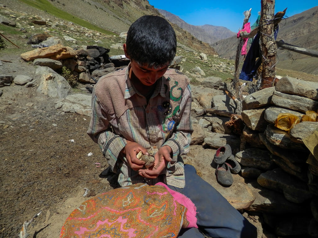
We will drive to the border town of Ishkishim and cross over into Afghanistan. Once in Ishkishim we will be staying at a guesthouse converted from the home of a local man. With the help of the Aga Khan Foundation local families are earning a little extra income this way. We spend one whole day in Ishkishim with our guide, making the final preparations and collecting our permits for the Wakhan region. Once we have left Ishkishim we will have to be self sufficient for 17 days and we need this day to ensure we have everything arranged. The guests will have time to explore the local environment and understand some of the Wakhi culture through our Wakhi guide.
Driving: 3 hours
Altitude: 2600m
The 250km from Ishkishim to Sarhad e Broghil takes us along the narrowest section of the Wakhan Corridor. Passing the 7500m high Noshak, Afghanistan’s highest peak, we will follow in the footsteps of Marco Polo and Hsuan Tsang on this ancient silk route. The road is poor and can be washed out in places but we hope to make it in two long but scenic days. We will have to stop in the village of Khandud to process some further paperwork and we plan to overnight in the village of Qala e Panja.
Driving: 6-8 hours
Altitude: 2800m
We make our way to the furthest point that we can by vehicle. At Sarhad e Broghil the road ends and any further journey must be made on foot or by horse. We spend the afternoon making our final preparations for our trek into the Afghan Pamir.
Driving: 4 hours
Altitude: 3250m
The geography of the region means that one of the toughest days trekking comes on the first day. The Wakhan Corridor becomes too steep to follow the river. For the first time since we joined the Panj River we move away from it, and instead must cross three passes. The first is the Daliz Pass (4260 metres) and will involve a vertical altitude gain of 1000 metres. We will overnight in Boharak.
Trekking: 7 hours
Altitude: 3450m
A further days trekking along the bank of the Wakhan River. We may meet Wakhi shepherds bringing their flocks back to the bigger villages for the winter. We overnight at Langar. Langar means ‘free buffet’ and is a classic spot for the Wakhi to graze their sheep and yaks.
Trekking: 6-7 hours
Altitude: 3600m
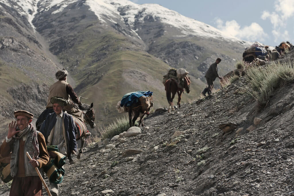
The scenery changes during this days walking from the steep sided valley of the Wakhan to the wide-open plains of the Afghan Pamir. We camp at the lowest of the Kyrgyz settlements of Khach Goz. At Khach Goz we may have to swap our pack animals from Wakhi animals to Kyrgyz animals. At Bozai Gombaz there is a chance to visit the nearby Kyrgyz tombs, rest or simply watch the Kyrgyz way of life.
Trekking: 5-6 hours
Altitude: 3800-4050m
An easy days trekking up one of the sources of the Amu Darya, the 9km long Chaqmaqtin Lake where the Kyrgyz nomads graze their sheep and yaks in the summer. We may well see a Bactrian camel train too. Our local guide has friends amongst the Kyrgyz and we will have time to meet and talk with them. We hope to exchange ideas about the world and to get an insight into their lifestyle and culture, living in yurts in this remote spot, high in the Pamirs.
If weather permits we will take the tough but spectacular high route back from Chaqmaqtin to Sarhad. Seeing more of the stunning Pamir Mountains. We return across the high plains, camping at the small Kyrgyz camp of Kurchin high above Bozai Gombaz.
Trekking: 5-6 hours
Altitude: 4100m
Trekking along Wakhjir river to the bottom of Dilisang pass 5290m or Wakhjir pass 4927m. Than back to Khash Goz. The trek is optional and the guest will choose themselves, to which point they can go. The guide, cook, and support team (animals and men) will just follow.
Trekking: 5-6 hours
Altitude: 4300m
After 2-3 hours the group will be at the top of the Aqbelis Pass (4600 metres) with great views of a small alpine lake. Another hour brings the group to a delightful lunch spot. In the early afternoon the group will arrive in Ghughumdeh for the night.
Trekking: 5-6 hours
Altitude: 4300m
Possibly the toughest day of the trip. Certainly the crossing of the Uween Sar Pass (4850 metres) is the highest point reached on the trip. An early start should see the group cross the pass around noon. From then on it is downhill to the small camp of Nauabad.
Trekking: 6-8 hours
Altitude: 4200m
From Barnaoz, where we overnight in a herder's shelter, the trail goes uphill westwards to the Karabel Pass (4 820 m) and then down to the Chap Dara Valley. At the northernmost tip of the valley, below the Showr Pass, there is a herder's shelter to overnight. The Shawr base camp and Shawr Pass offer some of the most beautiful mountain scenery of the whole Pamir.If the river is low, as it can be at this time of year, then we have an option of making this day an hour or so shorter by fording the river to reach our overnight camp of Shawr.
Trekking: 5-7 hours
Altitude: 4500m
From the Shawr base camp, it is a 2-hour climb to the Shawr Pass (4 890 m) via the Shawr glacier. The Shawr Pass is the gateway to the Big Pamir. The Shawr Pass is high and can be dangerous as it is a combination of glacier and rocks that make it very difficult for horses to get through. In any case, it should not be attempted in bad weather condition. Showr Pass may not be passable after heavy snowfall. From the top of the pass we can see Tajikistan mountains and lake Zorkul. It is about 6 hours trekking to Saremokor where we stay overnight. Lake Zor Kol is a further 1.5 hour hike from there. Saremokor and surrounding settlements is a good area to discover the Kirghiz way of life. There is no lodging option near Lake Zor.
OPTION 1. (In case if the river is too high to cross, it is also possible from Sarhad, there seems to be a direct route northbound to Zorkul via Tarbitoq or Ptukhshur valley that comes out into the Chap Dara valley to Shawr. This route may be slightly quicker that the route via Baharaq. Allow two days to Shawr Camp).
Trekking: 6-8 hours
Altitude: 4125m
After a couple of hours walking around Zorkul, we return to Saremokor, than westwards and we will get to the settlement of Mollah. There are actually two settlements that have that name, separated by one-hour walking distance. From Mollah to Bechkonok, it is a 3-hour hike. Less than two hours later is the Elghonok Valley where Buzkashi games are occasionally organized. We may overnight in Bechkonok as well, if the group is tired.
OPTION 2. There are several options to travel between the Big Pamir and Wakhan in either direction. A river route that goes along the Amu Daria from Bitebet all the way to Ghaz Khan. A high route that stays away from the Amu Daria and that crosses another high pass before coming out in the Wakhan Valley in either Ouezet or Sargaz. Coming from Zor Kol the river route is certainly physically less difficult and more straightforward than the high route. However, there is nobody living on the river route between Elghonok and Ghaz Khan while there are many settlements (both Wakhi and Kirghiz) on the high route. While the high route may therefore be more culturally interesting, the river route, especially between Ali Su and Ghaz Khan, is really beautiful. Note that it is possible to walk up and down most valleys (Shikarga, Ali Su, Bitebet...) and therefore alternate walking on the high and the river routes.
Trekking: 6-7 hours
Altitude: 3800m
Elghonok is the last settlement on the river route before Ghaz Khan. It takes a minimum of 3 days to cover the route between Elghonok and Ghaz Khan. Beyond Elghonok, the route goes down to the Amu Daria at Bitebet Valley via Taly Bay Valley. Then come the valleys of Ali Su, Manjalaq and Shikarga. There are many herder's shelters all along the way so it is never a problem to find a place to overnight. Between Shikarga and Ghaz Khan, the route goes via Djangal and the scenery is fantastic. Both Shikarga and Djangal are beautiful places to overnight. For overnights, we use tents.
Trekking: 4-5 hours each day
Altitude: 2800m
The drive back to Ishkishim should be relatively smooth at this time of year as the river levels are low after the summer snow melt. Once back in Ishkishim there will be time to rest and say goodbye to our Wakhi guides.
Driving: 4-5 hours
Altitude: 2600m
We cross back into Tajikistan and head back up the Pamir Highway. Khorog will seem like Las Vegas after nearly three weeks in the little Pamirs.
Driving: 3 hours
Altitude: 2100m
The long drive back to Dushanbe will be broken at the small town of Kalaikhumb.
Driving: 6-7 hours
Altitude: 1250m
Drive to Dushanbe along Panj river. Breaks for lunch in Kulyab. Overnight in hotel in Dushanbe.
Sightseeing of Dushanbe. Visit of National museum, Flag park, Somoni monument, Souvenir shops, Evening transfer to airport and flight back home. End of the tour.
Dates & Prices
| Dates | Availability | 2 Pax | 3 Pax | 4 Pax | 5 and more |
|---|---|---|---|---|---|
| Your dates - Private group | July - September | US $3,750 | US $3,200 | US $2,980 | upon request |
What’s included
- 26 breakfasts, 25 lunches, 25 dinners
- Airport transfers on arrival and departure days
- Accommodation in 3* Hotel single/twin share rooms in Dushanbe
- Guesthouse and Homestay accommodations en route
- Twin share tents on trek
- All private transportation
- English speaking local mountain guide
- All park entrance fees and trekking permits
- Camp cook and porters from 6th to 21st days of trek
- Pack animal support and horses for ride from 6th to 21st days of trek
- All required permits in Afghanistan
- All required permits in Tajikistan
- All group camping equipment
What’s not included
- Sleeping bags and mats are not provided but can be hired locally
- International airfares
- Visas (two single entry or multiply for Tajikistan and single entry for Afghanistan)
- Travel Insurance
- Meals and beverages not mentioned in the program
- Items of a personal nature such as laundry, phone calls, alcohol, etc
- Tips and gratuities
Safety
Wilderness trips always create danger of their own, so, especially in Afghanistan, even though this is “out of terrorist zone” please note, that the tour leader has the final word of regarding the changes in itinerary for safety matters. While we travel in Afghanistan, please keep in mind that we are going to visit the country with the Muslim regime, and to respect the local concepts of faith and traditions can help us in better understanding of local lifestyle and our free explorations of the nature. Therefore, please try to dress less defiant; also, women have to cover the head. Walking in sleeveless shirts and shorts is not recommended. When we back in Tajikistan, you can feel free with your wearing.
Important notes
All our small group tours have no local payments, hidden extras or compulsory single supplements.